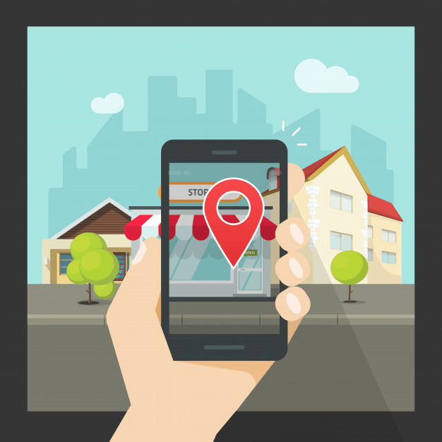
How to Build an Augmented Reality GPS App
How many times have you almost ended up in a narrow street while just following the navigation instructions? Well AR enabled Apps take it to the next level as they add digital objects into the real world!

Nowadays, whenever we need to go somewhere, we have mobile apps to guide us and help us find the best route. GPS tracking apps help us reach our destinations with the fewest instructions and lightest traffic. The rapid growth of GPS navigation shows that consumers are increasingly using smartphones while traveling.
77% of smartphone owners have navigation apps on their phones.
Using navigation apps users can avoid getting lost. They can easily discover new places, read reviews of those places, share that information, and so on. A recent navigation app market report showed that GPS apps are going to bring $34.56 billion in revenue by 2021. Hence it is inevitable to accept the fact that navigation apps are a profitable business.
However, with the rise in technology, navigating solutions have improved using augmented reality. Entrepreneurs are now adopting smart solutions by integrating augmented reality tools into their apps and services. Location-based augmented reality is one of them.
Augmented reality solutions market size will reach $209 billion by 2022.
Augmented reality GPS is the next big thing. Navigation along with augmented reality tools works wonders when it comes to user experience. In this article, we are going to expand our research and provide you with detailed information on implementing AR in navigation apps. We are going to look into the aspects of augmented reality GPS apps. But first, let’s have an introductory look at augmented reality.
Here’s everything we’ve covered:
- What is Augmented Reality?
- Augmented Reality in Navigation Industry
- How does Augmented Reality Geolocation apps work?
- AR Navigation Solutions: Use-cases
- How to Build an Augmented Reality GPS App
- Challenges for Development
- Custom Apps: Only Solution to Standout in the App Market
- Cost to Build an Augmented Reality GPS App
- Unique AR Navigation Apps
- The Bottom Line
What is Augmented Reality?
AR is an ability to add digital objects into the real physical world to perceive a live experience with the help of a camera. Users may or may not interact with those elements of the live view.
The most striking example of augmented reality is the gaming app: Pokémon Go. While playing it, through the smartphone camera, users can actually see Pokémon in the real world. Augmented reality features hold substantial efficiency to enhance customer experience and brand value. Similarly, with the help of AR, multiple such objects can supplement the world around us.
Augmented Reality in Navigation Industry
Thanks to maps and geo-locations that we do not need to ask the passers-by for the route guideline or traffic situations anymore. But they solve our problems only partially. Hence, Augmented reality GPS solutions come into the picture.
Augmented Reality GPS solutions allow supplementing real-world objects on the app screen by pointing the device’s camera. In addition to this, there are various tips involved that include comments about buildings and routes, popular landmarks, restaurants, ATMs, shops, and so on. Hence there are lots of ideas for mobile apps focused on the augmented reality GPS concept.
How does Augmented Reality Geolocation apps work?
Augmented reality geolocation apps collate GPS cellular data and the virtual compass to discover the exact location of the device. First, it identifies geo-markers. The sensors on the device determine its exact position. Then, the GPS along with a digital compass and accelerometers usually determines the location.
When the app identifies a specific point of interest, it triggers AR elements. Other than objects and text, these elements can include music, animations, and videos. Some of these apps allow users to manipulate these virtual objects, while some don’t. It is important to note that Augmented Reality Geolocation apps work only if we implement geopositioning and augmented reality technologies correctly. Here are a few reasons to use Augmented Reality GPS solutions.
AR Navigation Solutions: Use-cases
1. City Navigation
This is the simplest, most obvious use-case of AR navigation apps. Augmented Reality Geolocation app can help users find their way when they seem lost in an unfamiliar area. This not only navigates but also gives a live on-street experience to reach your destination.
This app is also helpful for tourist navigation. Say, if monuments or historical buildings come in sight of the person with such an app, the app will display information about the particular cultural site.
For industrial facilities and educational institutions also, it works in a similar way. The augmented reality GPS apps help to accurately navigate a particular institution, be it a factory or a university complex.
2. Time-Saving and Security
The most advanced programs increase driving safety. But to do this the application must work accurately to give instant signals in real-time. This can happen by scanning the surrounding space and by measuring the distance to objects within seconds. Augmented Reality GPS apps pave the best possible routes. This can happen via providing data of certain routes and traffic jams in real-time.
3. In-door shopping centers and malls
Customers visiting shopping malls and entertainment centers can orient themselves more quickly if they have an Augmented Reality GPS app. This app can help them by telling them what is located where.
There are multiple reasons why AR suits indoors navigation. AR visual markers can accurately map out smaller areas. AR offers a potential solution to improve indoor positioning accuracy as compared to regular GPS apps. Indoor AR navigation that works on visual positioning systems are better suited for larger indoor areas like malls.
4. Logistics Industry
According to a report by INRIX and the Centre for Economics and Business Research, traffic congestion is estimated to cost Americans $186 billion in direct and indirect losses, uptil 2030. This is also likely to affect the logistics industry. AR GPS navigation can help solve this and save the logistics industry millions of dollars.
AR navigation features make delivery extremely easy by giving a live visual orientation of a route. AR assisted navigation tools can guide workers to the exact location of parcels with ease and remove erroneous picks. It also helps conduct more efficient delivery of goods by optimizing navigation on roads.
5. Advertising Industry
Location-based Augmented Reality can contribute to advertising also. If there is an annual sale at your store and attract as many customers as possible. Using the AR experience, you can achieve this goal. Passers-by who are AR app users would see the corresponding ad flashing in front of them if they target their phones at the store.
So, these were the use cases of Augmented Reality Geolocation apps. Have a similar app development idea for your Industry Specialization?
How to Build an Augmented Reality GPS App
Step 1: Prepare the Required Data
The very first step would be to choose the kind of data that you want to add to the real world. Apps like Yelp Monocle and Wikitude implement the most straightforward data. They simply display text information. Implementing 3D colorful objects is comparatively difficult.
Step 2: Choose Development Tool
This is without any doubt the most essential step. It is quite important to choose the best Augmented Reality GPS Software Development kit that can meet all your requirements. Some well-known and powerful tools for developing the AR app are as follows.
i) AR Kit by Apple
We mentioned this SDK previously. Let’s have an in-depth look at it. Here are some of the basic features of the AR Kit by Apple.
- Visual Inertial Odometry: This feature helps combine computer information from the camera. You can precisely track real-world environments using this feature.
- Environment scanning: Using this feature you can scan both vertical environments as well as horizontal environments.
- Face Tracking: It allows us to create advanced virtual in-app effects using powerful face tracking features.
- Light Estimation: This SDK adjusts the amount of light in the virtual world based on the light in the real world.
- Compatible with Unity and Unreal: AR Kit is compatible with games and apps built on the Unity and Unreal game engines.
- GPS and simultaneous localization and mapping (SLAM) support: AR Kit is compatible with games and apps built on the Unity and Unreal game engines.
The latest AR Kit 2 allows several users to cooperate with each other in a single virtual environment. Apple also introduced a new USDZ format that enables developers to share and create AR items easily. It has a major impact on the AR market specifically available for iOS developers and users.
ii) Google ARCore
The Google ARCore software development kit also supports the Unity and Unreal game engines. Here are some basic features it provides:
- Light Estimation: This feature enables virtual elements to match the lighting in the natural environment.
- Motion Tracking: ARCore allows your app to detect the motion of the virtual elements and also trigger those virtual elements.
- Environment Scanning: Using ARCore, you can make your app detect horizontal surfaces and place virtual objects on them and vice-versa.
Google ARCore works well specifically with the Android version 7.0 and higher and it is absolutely free. Here’s a list of all supported devices.
iii) Wikitude
Wikitude is compatible with iOS as well as Android platforms. Here are the latest features from the latest updated SDK8 edition:
- Scene Recognition: This advanced SLAM feature helps recognize and track large objects like rooms, landscapes, buildings, etc. It is also easier to implement a created 3D object in the app, due to the Unity plugin.
- Extended Object Tracking: This feature allows users to scan an object and see augmentations in the real world even when the marker isn’t visible in the camera view.
- Other Features: Besides the above three features, Wikitude offers geolocation support, integrations with various frameworks like Xamarin and Cordova, integration with smart glasses, GPS support, and many more features.
The Wikitude toolkit allows creating Augmented Reality GPS apps for Android, iOS, and AR glasses. But Wikitude is a bit costlier compared to other such services.
Step 3: Integrate geolocation data
The next step would be integrating geolocation into your app. Some SDKs might provide the mapping function while some may not. So, it is best to integrate it yourself.
GPS is the most common way to determine outdoor location. It is accurate, precise, and has the ability to determine your position literally from anywhere in the world. But it also is highly energy-intensive. You can use Android Location services or iOS Location Service for this purpose.
Challenges for Development
While the AR developments in recent years have made the technology more accurate and accessible, there are still some challenges for AR developers. Let’s have a quick look at it.
- Various sensors on the smartphone devices must be queried correctly at the same time in order to take a position into account accurately.
- You also need to be able to accurately display points of interest or the “virtual” aspects you want to be layered on the screen. Irrespective of the angle of view that the smartphone camera is pointing at, it should show accurate results.
- The technique used for calculating the distance between two points must be efficient and reliable. This technique is usually based on GPS data. But this data can suffer from errors at times.
- Another thing that developers should make sure of is that the augmented reality objects must remain static regardless of the users’ movements.
Overall, the main challenge lies in maintaining accuracy which is a crucial factor for any AR app. App publishers must be able to reliably maintain accuracy with their apps.
Custom Apps: Only Solution to Standout in the App Market
Many business entrepreneurs opt for a clone app, because of the common perception of clone apps being reliable and cost-effective. But there are certain drawbacks of the clone apps too. As cool as the app cloning approach sounds, it is not practical enough. After all, an original is worth more than a copy.
The overall quality and originality of mobile applications take a nosedive, because of clone apps. Many app publishers face problems like up-charging, bad UI/UX, less scalability, and poor functionality. Custom apps are an answer to the question of how to make an AR GPS app unique. Hence, it is advisable to take the custom app route when you make an AR GPS app. Here are a few benefits of custom apps in contrary to the drawbacks of clone apps:
Scalable: Custom can be personalized based on one’s business needs because they are built from scratch.
Functionality and Quality: Clone apps compromise the quality be it in terms of functionality or appearance. Custom apps have the potential to deliver qualitative results because your app development project is in the hand of a professional developer.
User experience: Users always look for something unique. Unique features intrigue user attention up to a larger extent. In custom apps, it is easy to introduce new and innovative features to solve this problem.
Advanced Features: With the app cloning approach, you have to go with the existing features that exist in the original app whether you want them in your app or not. Take the customer app approach to get rid of this extra baggage of unwanted features.
Cost: You may think that creating a clone app is cost-effective and affordable. The quality of apps is quite low in clone apps. Therefore, trying to salvage your app built with clone software may cost you even more than custom apps.
iOS App Store Law for Clone Apps: Apple introduced a set of rules for its App Store against clone apps. The apps built through app generation services, or by commercialized templates will be rejected from launching on its store. Custom apps have never faced such issues because they are original, and will never do!
So, these were the benefits of custom apps. Are you still hung up on the low-cost clone apps? Well, the difference between custom and clone apps is not much. Can’t believe it? Read ahead.
Cost to Build an Augmented Reality GPS App
Biztech Consultancy assures you affordable pricing for the successful execution of your Augmented Reality GPS app idea. While calculating the actual cost of developing an Augmented Reality GPS app for Android or iPhone, the platform (Android or iOS) plays an important role. It affects the total number of hours of our expert developers.
Unique AR Navigation Apps
Here, we have accumulated some of the best existing AR navigation apps with unique features. This will give you a better understanding of the AR navigation app features and ideas. We have also highlighted some key takeaways from the following examples for your app development idea. Let’s take a look:
1. AR City
AR City, owned by Blippar, is another famous example of Augmented Reality GPS apps. It simplifies urban navigation with an iPhone augmented reality app.
It provides the most accurate information about nearby sights and streets. It is available in more than 300 cities. The application works in a simple way. The users, by giving access to the camera can look around and find the shortest path to the location that they need. The built-in-compass comes in handy during the hike.
2. Sygic

Sygic added a new AR feature to its popular GPS navigation app. Now, more than 200 million users around the world enjoy AR to improve their navigation experience. It uses GPS along with a smartphone camera and uses an on-screen virtual path to simplify the navigation journey.
3. Augmented Reality GPS by Yahoo
In Japan, Yahoo updated its iOS maps by adding the Augmented Reality mode. Their users can take advantage of the iPhone AR app with real-time navigation. The developers approached this idea of integrating computer graphics into a physical environment. And implemented it using ARKit.

The user can leave traces and can see marks with the indication of the distance traveled. During the journey, users are accompanied by a Kensaku puppy.
4. Google maps & AR navigation
Google maps and AR navigation has been the hottest topic of discussions since its inception. In Google Maps GPS coordinates determine the user location. To make orienting oneself more accurate, the company decided to take the advantage of a camera and then implement an AR user experience.
This can help to navigate to an accurate location. This is because the service already knows the approximate coordinates of the location and now by comparing images with the photos from the street view database, the user can get precise results. During the journey, the navigation app displays arrows that indicate directions on top of the real world.

Google also warns its users to not walk the streets with their eyes on the screen. This is to avoid any collisions or unpleasant situations. As soon as the users launch the app, a warning appears, and if there is no reaction following, the screen brightness automatically decreases.
The Google Maps team tried different versions of AR tips other than arrows to show directions. One idea was to add a virtual character as a guide, but the danger was of users looking at the smartphone all the time. For now, the developers have implemented the arrows as a tips format, but the design can change anytime.
A Wall Street Journal columnist, David Pierce, after trying the AR feature by Google stated that: “The AR mode is especially useful when starting navigation, as it allows you to immediately determine the correct direction.”
The Live View feature is only available for walking directions yet.
5. Yelp Monocle – location-based Augmented Reality

Yelp is one of the best mixed reality apps available in the market. It helps discover nearby local buildings, events, restaurants along with their details
Yelp opens up with some cool features for users. The monocle is a hidden feature on the app. After providing the access to the app to use their phone cameras, users can see the boxes pop up for businesses or services nearby wherever they point their camera at.
6. Pokémon GO

Various AR apps and gaming apps are also popular nowadays. One such particularly famous is Pokémon Go. It is the first Augmented Reality GPS mobile game to reach such heights of popularity. Capturing the attention of gamers of all ages, it allows users to capture the visual creatures that are superimposed throughout the real world, visible through the device’s camera.
Pokémon GO does not require any specific equipment or resources. The simplicity of the game is one of the biggest factors which attracts players all over the streets across the world, trying to catch them all. The in-game locations can be set to any area, shop, and so on.
7. Magical Parks
Magical Parks has got the kids across New Zealand and Australia interested in going to their local parks outdoors. This crucial enticement to exercise has been a positive aspect of AR apps.

In this case, the app creates a virtual world that appears within the real-world landscapes of the parks. This virtual world is visible through your device. Kids using this app may see dinosaurs or talking bears as they roam through the park. Parks Week, which is a yearly event to celebrate the vital role parks play in creating liveable cities and thriving communities uses this app as a promotional tool. The app is seen as a great way to connect people with their outdoor spaces.
8. LiveGuide
LiveGuide lets the travelers on the Zentralbahn train line connect with their surroundings. This app points out features of interest along the journey to users and keeps them updated as they move through the journey.
9. Star Walk
The Star Walk app is a perfect one for all who are interested in astronomy and want to look up at the sky to find out what they are looking at. With the help of the GPS, the app shows which stars should be visible at the location you currently are at.

All a user needs to do is, point the smartphone toward the sky. This will give the names of stars, constellations, and visible planets if any. If users point the device at the ground, they’ll get to know the names of stars and constellations visible in the opposite hemisphere. This is a great example of how location-based augmented reality can be used for educational purposes also.
10. Wikitude
A Wikitude app is a tool that helps users to view everything from Tweets to reviews of the place at which they are pointing their camera at. Users can get all the useful information for stores, experiences, or features in their area. This core function is still the main attraction for users.

Wikitude also introduced a new feature as a platform for marketers. Businesses are now able to create their own augmented reality experiences using the Wikitude studio. They can also publish it to the app. This helps them create interest in their store and products or can also use it for promotions.
The Bottom Line
Location-based augmented reality is not new but is a tempting and lucrative idea. Modern technologies give you a great opportunity to create unique AR products for your users and attract attention to your brand. Augmented reality is a buzzword, but combined with geolocation, it has the potential to largely gain traction. Still not sure if the juice is worth the squeeze?
Get in touch with us and let’s discuss your idea!